

LATEST: Further details emerge on planned flood relief scheme in Kilkenny

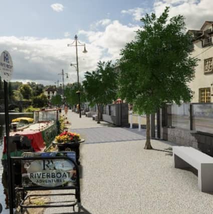

Proposed flood relief scheme put before councillors at plenary meeting of Kilkenny County Council
Further details on the Graignamanagh–Tinnahinch Flood Relief Scheme were put before elected members at the most recent plenary meeting of Kilkenny County Council.
The scheme aims to address the significant flood risks affecting Kilkenny City and Tinnahinch, primarily from the River Barrow and also from the River Duiske in Kilkenny.
The project is led by Kilkenny County Council in collaboration with Carlow County Council and the Office of Public Works (OPW), with the goal of creating a flood relief scheme that meets all relevant standards.
The programme began with feasibility assessments and public engagement activities between June and July 2020. This phase involved a constraints study, surveys, hydrological and hydraulic modelling, and stakeholder consultations.
Additional engagement events were held to gather feedback and present emerging options, with one major milestone occurring in August 2022 when the preferred option was introduced.
The design and assessment work continued into 2025, with a key update in January.
Cultural heritage was a key consideration in the planning process, with protection measures being proposed for important sites such as the Clapper Bridge, Lady’s Well, and a stone masonry arch bridge on the River Duiske.
Environmental issues were also central, including biodiversity enhancement and ecological surveys of local species and habitats.
The preferred option selected was Option 3, which combines raised defences with a floodwater storage area.
This option was chosen for its lower construction risks, reduced environmental impact, compatibility with local ground conditions, and limited disruption to the nearby Special Area of Conservation (SAC).
The scheme is geographically divided into key areas such as the Storage Area, Well Lane, Turf Market, Graignamanagh Quay, The Boat Club, The Dock, The Hub, Hotel Street and Tinnahinch Quay.
These locations will see various flood mitigation structures implemented.
Currently, the project is in Stage 2, which involves the planning and development consent process.
This stage includes producing final planning drawings, engaging with landowners, conducting the Compulsory Purchase Order (CPO) process, and preparing both the Environmental Impact Assessment Report (EIAR) and Natura Impact Statement (NIS).
The final step in this phase will be the submission and decision of the Part 10 Planning Application.